
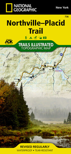
Waterproof • Tear-Resistant • Topographic Map
National Geographic's Trails Illustrated map of the Adirondack Park, Northville-Placid Trail combines unmatched detail with helpful information to offer an invaluable tool for making the most of your visit to this 130 plus mile long trail. The Northville-Placid Trail (NPT) is the jewel in the crown of the Adirondack Park trail network. The NPT was constructed in 1923 through remote lake country. The map is expertly researched and created in partnership with the Adirondack Mountain Club (ADK).
This map can guide you off the beaten path and back again through the wildest and most remote sections of the 6.1 million acre Adirondack Park. The trail is commonly traversed from south to north with hikers starting at Northville in the Shaker Mountain Wild Forest. From there hikers travel through the Silver Lake Wilderness then past Piseco Lake and into the West Canada Lake and High Peaks Wilderness areas. The northern terminus of the trail is near the town of Lake Placid, home to the 1980 Winter Olympics. Along the way the numerous features are shown including shelters, designated backcountry campsites, and stream crossings.
Every Trails Illustrated map is printed on "Backcountry Tough" waterproof, tear-resistant paper. A full UTM grid is printed on the map to aid with GPS navigation.
Other features found on this map include: Piseco Lake, Panther Mountain, Blue Mountain, Vanderwhacker Mountain, Owls Head Mountain, Owls Head Mountain, Adirondack Mountains, Adirondack Mountains, MacIntyre Mountains, Iroquois Peak, Boundary Peak, Algonquin Peak, Tupper Lake, Tupper Lake, Street Mountain, Ampersand Mountain, Upper Saranac Lake.
With miles of clearly marked trails that include mileages between intersections, this map will prove invaluable in your exploration of the region. The Central Trail Chart will help you choose a trail that’s right for your activity level and recreation use whether you’re hiking, horseback riding, biking, snowshoeing, cross country skiing, or snowmobiling. Recreation features are clearly marked, including campgrounds, climbing areas, fishing access, swimming areas, marinas, and ski areas. The map base includes contour lines and elevations for summits, passes and many lakes.
Every Trails Illustrated map is printed on "Backcountry Tough" waterproof, tear-resistant paper. A full UTM grid is printed on the map to aid with GPS navigation.
Other features found on this map include: Baldhead Mountain, Blue Mountain, Gloversville, Indian Lake, Panther Mountain, Piseco Lake.
- 4.25" x 9.25" folded; 37.75" x 25.5" fully opened
- Scale = 1:75,000
- Map revised - 2013